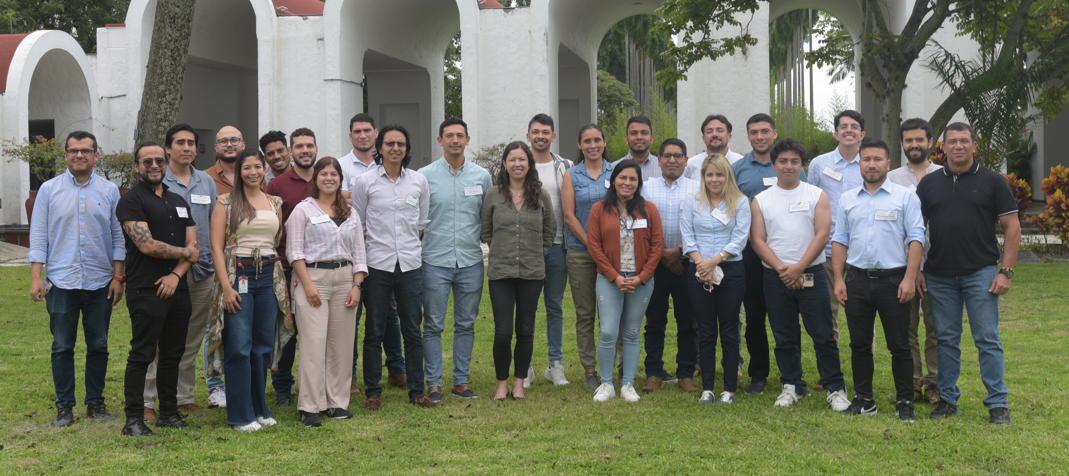
From the 27 to 31 of May, The Alliance of Bioversity & CIAT campus at the headquarters of the Americas hub in Palmira (Colombia), opened its doors to a group of 19 professionals from public and private organizations and universities from Colombia, Ecuador and Peru.
The objective? To offer a training workshop where participants would be provided with basic skills and knowledge in the use of technologies and tools based on Digital Soil Mapping (DSM) and Artificial Intelligence (AI).
What is Digital Soil Mapping? DSM is a computational technique that integrates field data (soils) with various types of geospatial data (remote sensing images, terrain attributes, climatic data, among others), within a mathematical, statistical or machine learning model, to produce high-resolution soil maps (raster/pixel) that are continuous and variable in space-time.
“The development and use of these methodologies allows the characterization, mapping and analysis of soils, accurately and efficiently, so that they are useful for decision making in areas such as agriculture, conservation, natural resource management and land planning, among others”, says Javier Mauricio Martín, instructor of the Workshop at The Alliance of Bioversity & CIAT.
During five days of training, the attendees, in addition to learning all the steps for SPM, were able to expand their knowledge about the use of this technique and how it connects to the work they do in their organizations.
“As a research entity, we always want to be at the forefront of all these technologies and innovations and really with what we are learning in this course and the group work spaces, I see too much application to the topics and even think about how to start applying them in several of the investigations we are doing in AUGURA”, says Juan José Pérez of The Association of Colombian Banana Growers (AUGURA).
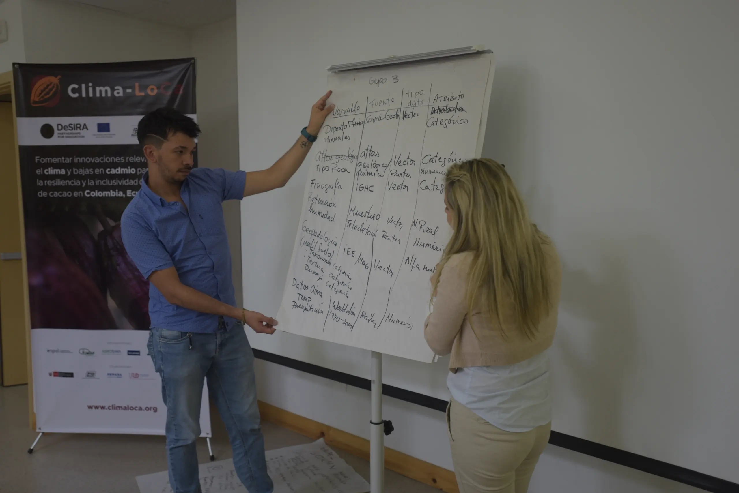
Through comprehensive and theoretical-practical training in spatial modeling techniques with R and R-Studio, the workshop covered the following topics: MDS principles, tools for the use and visualization of geospatial data, field sampling and analysis methods, cleaning, processing and standardization of geospatial data, use of Artificial Intelligence in spatial soil modeling, and validation and uncertainty of soil maps.
“I see these learning spaces as very relevant and adequate since, in my case, they are knowledge that contribute to my organization, especially the topic of modeling that was very well explained and useful, taking into account that we are working digital soil mapping for cadmium and later we will work for other variables, then we were working in a very general way and now with the application of the course I think that our work can be more specific”. Andrés Felipe Rodríguez of The Agustín Codazzi Geographic Institute (IGAC).
Why is it important to know the essential techniques and concepts of Digital Soil Mapping? The DSM is an essential tool to know the spatial variability of the different soil properties, thus allowing to optimize the use of fertilizers, support the prioritization of mitigation strategies for heavy metals such as cadmium (Cd), monitor soil organic carbon stocks, among others. It is precisely these issues that evoked the need to offer this training space and disseminate its usefulness for the sustainable development of agriculture in the participating countries,” says Mayesse da Silva, Senior Soil Scientist at The Bioversity & CIAT Alliance.
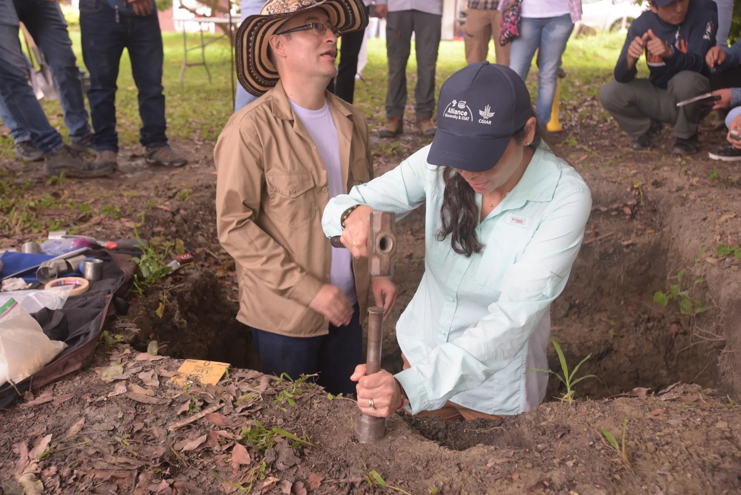
This five-day meeting provided participants with the basics in DSM and during the practical session in the field and laboratory, the importance of good sampling to ensure adequate spatial modeling was emphasized. Participants learned about different sampling and data collection methods in the field, followed by a visit to The Analytical Services and Greenhouse Gas laboratories to learn about methods for quantifying soil properties and greenhouse gas emissions.
On the last day, the participants worked on a collaborative development with data from Ecuador with the objective of applying the different topics learned during the week.
Before closing the workshop, a feedback session was held where instructors and participants could take stock of the lessons learned, aspects to improve, challenges and commitments that each participant was left with at the end of the course. Finally, certificates attesting to participation were presented to assistants.
“It is very interesting this learning space and in fact I really appreciate what The Alliance of Bioversity & CIAT team did to try to meet a very tight schedule because the topic of Digital Soil Mapping is very extensive, they are classes that take semesters for their specificity and depth and now we see that in the end the results are being given, so it is a lot of information, but the way they are teaching it is very successful and outstanding”, says Wilmer Jimenez of MAG.
This event was possible thanks to the contribution of the projects of Clima-LoCa, financed by the program DeSIRA for the European Commission, STDF and the Fertilize Right program of USDA.